
What Is Geofencing in Fleet Management?
Michael Bar
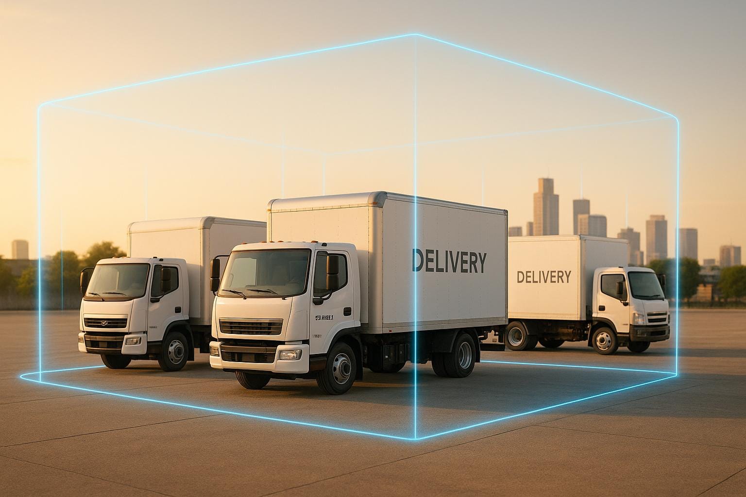
Geofencing in fleet management uses GPS to create virtual boundaries around specific locations, like depots or customer sites. When a vehicle crosses these boundaries, automated actions like alerts or event logging are triggered. This technology improves vehicle security, tracks movements, and optimises operations.
Key Points:
- Security: Alerts for vehicles leaving defined areas, aiding theft prevention and recovery.
- Efficiency: Tracks arrivals/departures, monitors routes, and reduces manual oversight.
- Cost Savings: Cuts fuel usage, lowers admin tasks, and can reduce insurance costs.
Geofencing is especially useful for UK fleets dealing with rising theft rates and operational challenges. By automating tracking and integrating with fleet management systems, it helps businesses stay in control while reducing risks and costs.
How Geofencing Works in Fleet Management
Technology Behind Geofencing
Geofencing combines several technologies to create and monitor virtual boundaries around physical areas. At its core are GPS (Global Positioning System), Wi-Fi, RFID (Radio Frequency Identification), and cellular data. These systems work together to trigger alerts whenever a GPS-enabled device crosses a set boundary. GPS provides location data accurate to a few metres, while Wi-Fi enhances precision in dense urban areas where tall buildings can disrupt GPS signals. RFID is particularly useful for short-range detection, such as monitoring entry and exit points at depot gates, and cellular networks ensure continuous communication between vehicles and fleet management software.
This flexibility allows fleet managers to design boundaries in various shapes - circles, squares, rectangles, or even irregular polygons that follow natural features like roads or property lines. For UK fleets, this adaptability proves essential, whether managing rural delivery routes or navigating the complexities of urban logistics. This technical foundation supports the step-by-step process of geofencing implementation.
How Geofencing Works Step by Step
With the technology in place, here’s how geofencing operates. It begins with fleet managers defining virtual boundaries using fleet management software. These boundaries can be as small as a customer’s premises or as large as entire cities or regions.
Once set, the system continuously monitors GPS data. If a vehicle crosses a boundary, the system logs the event, recording details like the timestamp, vehicle ID, and location coordinates. Depending on the setup, this can trigger automatic actions such as sending SMS alerts, logging the event, or issuing email notifications.
Geofencing can function in two ways. Active geofencing requires driver interaction, such as confirming their arrival via an app. In contrast, passive geofencing operates in the background, automatically recording boundary crossings without driver involvement. For UK fleets, passive geofencing is often preferred, as it reduces administrative tasks while maintaining accurate tracking.
Common Uses for UK Fleets
Geofencing has become a vital tool for fleet operators across the UK, addressing operational challenges and improving security. In logistics and delivery services, it enables real-time tracking, optimised route planning, and precise monitoring of arrival and departure times. This is especially useful for managing multiple deliveries in congested urban areas.
In construction, geofencing plays a key role in safeguarding workers and expensive equipment in hazardous zones. It also helps deter theft of both powered and non-powered assets. For instance, a wholesale construction supplier implemented polygon-shaped geofences to prevent trucks from entering high-risk recycling areas, reducing losses and enhancing asset security.
For company vehicle fleets, geofencing improves oversight by preventing unauthorised use and ensuring accurate mileage tracking. Private hire and rental services use it to ensure vehicles remain within designated areas, while public transport operators rely on it to monitor routes and comply with regulatory requirements.
Additionally, when integrated with fleet management systems, geofencing can provide near-instant alerts if a vehicle or valuable equipment fitted with a GPS tracker is removed from a designated area without permission. This added layer of security is crucial for protecting fleet assets.
Benefits of Geofencing in Fleet Management
Better Vehicle Security
Geofencing adds a layer of protection to fleet management by setting up virtual boundaries around vehicles and key assets. Fleet managers are instantly notified whenever a vehicle crosses these boundaries - whether it's entering or leaving areas like depots, garages, or customer locations. This early-warning system helps detect and address unusual activity before it escalates.
"Geofencing acts as a preventive measure against theft. Fleet managers can set up geofences around specific areas where assets are located. If a vehicle or asset leaves the defined area, an instant notification is sent, allowing for immediate action to prevent theft and save costs." – Webfleet
In cases of theft, real-time location tracking can be shared with law enforcement, improving recovery chances. For example, if construction equipment unexpectedly leaves a job site, managers can quickly determine whether it's being stolen or moved improperly. Some systems even allow remote immobilisation by disabling the vehicle's engine if theft is confirmed. Beyond theft prevention, geofencing ensures vehicles stay within approved zones and operate during authorised hours, reducing risks and improving compliance.
Better Fleet Efficiency
Geofencing isn't just about security - it also helps streamline fleet operations. By automating notifications, it tracks when vehicles arrive at or leave specific locations, saving time and improving scheduling. The data it provides can reveal traffic patterns and delivery times, allowing managers to refine routes, reduce mileage, and cut fuel costs.
Take the example of a logistics company that used geofencing around key delivery points and restricted zones. They achieved real-time delivery tracking, reduced manual data entry, and improved customer satisfaction through instant updates. This approach led to a 15% reduction in operational costs, thanks to more efficient routes and reliable deliveries. Additionally, geofencing helps monitor driver performance by tracking adherence to routes and schedules, providing valuable insights for training and recognising top performers.
Cost Savings
Geofencing also brings notable financial advantages. By optimising routes, fleets can significantly reduce fuel consumption, which is one of the biggest operational expenses. Insurance premiums may also drop, as insurers often reward the added security and monitoring capabilities that geofencing provides.
Lower accident rates, reduced wear and tear, and streamlined administrative tasks further contribute to cost savings. For example, automated processes eliminate the need for manual timesheet entries and delivery confirmations, saving both time and money. By improving vehicle usage and preventing unauthorised operation, geofencing helps UK fleet operators maximise their investments, regardless of fleet size.
How to Set Up Geofencing for Your Fleet
Step-by-Step Setup Guide
Start by identifying the key areas tied to your fleet operations - your depot, customer locations, restricted zones, and high-risk areas. These locations will serve as the backbone of your geofencing setup, so think ahead about both your current and future needs.
Using your fleet management software, access the mapping tools to create virtual boundaries on a digital map. Most tools offer a simple point-and-click interface to draw these boundaries. Circular geofences are ideal for depots or customer sites, while irregular areas like construction sites or industrial estates might require polygon shapes for better accuracy.
Once the boundaries are in place, configure the geofence rules and set up notifications. For instance, you could create alerts for vehicles entering customer sites during delivery hours or leaving the depot outside of approved working hours. The system tracks vehicle positions in real time using GPS, Wi-Fi, or cellular data to enforce these rules.
Before going live, test the setup by simulating vehicle movements through the defined zones. This helps ensure the alerts work as intended. During testing, you might find the need to tweak the boundaries - perhaps a geofence excludes part of a car park or overlaps with neighbouring properties. Fine-tune the setup until it accurately reflects real-world conditions.
Finally, link the alerts to SMS, email, or in-app notifications. This allows you to respond promptly to unauthorised trips, security breaches, or inefficiencies without constant manual monitoring. Once your geofencing system is up and running, stick to best practices to keep it effective and relevant.
Best Practices for Geofencing
Regularly reviewing your geofencing data is essential for long-term success. Set aside time weekly or monthly to analyse patterns like unauthorised stops, route deviations, or excessive idling. These insights can guide decisions to optimise routes, cut fuel costs, and hold drivers accountable. Automated reporting also eases compliance requirements and reduces administrative burdens, saving both time and money.
Keep your geofence zones updated as your business grows and changes. Customer locations may shift, and new service areas may emerge. A quarterly review process can help you adjust boundaries, add new locations, and remove outdated zones, ensuring your system stays accurate and relevant.
Training your staff is just as important. Your team needs to understand how geofencing works, how to interpret alerts, and what steps to take when an alert occurs. Providing thorough training on your fleet management software, including privacy and compliance policies, ensures everyone is equipped to use the system effectively - even as new features are added over time.
Clear objectives are crucial for getting the most out of geofencing. Whether you aim to enhance security, reduce unauthorised vehicle use, or streamline routes, having well-defined goals will help you configure the system properly and measure its impact. Periodically revisit these objectives to ensure they align with your overall business strategy.
Lastly, think about integrating geofencing with other fleet management tools. Combining it with GPS tracking, telematics, and reporting systems lets you monitor vehicle locations, automate event logging, and analyse data all from one dashboard. This integration can also support compliance tracking, maintenance scheduling, and driver behaviour analysis, creating a more comprehensive solution for managing your fleet.
GRS Fleet Telematics: Geofencing Solutions for UK Fleets
GRS Fleet Telematics Features
GRS Fleet Telematics introduces dual-tracker technology to UK fleet operations, offering enhanced vehicle security and geofencing capabilities. This approach uses two independent tracking systems per vehicle, significantly reducing the risk of vehicle loss if one tracker is disabled.
The system’s real-time geofencing feature works seamlessly with the dual-trackers. Fleet managers can set up virtual boundaries around key locations such as depots, customer sites, or restricted areas. When a vehicle crosses these boundaries, instant alerts are triggered, allowing for immediate action in cases of unauthorised movements - whether due to a potential security breach or a driver straying from an approved route.
One standout statistic is the 91% recovery rate for stolen vehicles, far exceeding the industry average of 70–80%. This high success rate is achieved through the combination of dual-tracker technology and rapid response protocols, enabling authorities to quickly locate and recover stolen assets.
Beyond theft recovery, the system offers robust prevention tools. Live tracking lets fleet managers monitor vehicles in real time, while automated reporting provides a detailed log of vehicle movements. Together, these features create multiple layers of security, making it much harder for thieves to successfully target and keep fleet vehicles.
The system integrates easily with existing fleet operations and aligns with UK business practices and legal requirements. These advanced tools are available in competitively priced packages tailored to meet the needs of diverse fleets.
Pricing and Plans
GRS Fleet Telematics offers powerful security features with flexible pricing options, making advanced fleet protection accessible to businesses of all sizes. Subscription plans start at just £7.99 per month per vehicle, covering SIM and data costs, platform access, and dedicated account manager support - ensuring predictable monthly expenses.
Businesses can choose from three hardware packages designed to suit different security requirements and budgets:
| Package | £ | Features |
|---|---|---|
| Essential | £35 | Single wired tracker for cost-effective real-time tracking |
| Enhanced | £79 | Primary tracker with a secondary Bluetooth backup for added theft protection |
| Ultimate | £99 | Includes both trackers plus immobilisation capability for maximum security |
The pay-per-recovery model means businesses only incur recovery fees when a stolen vehicle needs to be retrieved, keeping ongoing costs manageable while ensuring full emergency support is available.
Installation is also affordable, especially when paired with GRS Fleet Graphics branding. Since 1991, GRS Fleet Graphics has been a trusted name, and now they offer free installation for businesses opting for professional vehicle branding - delivering a solution that enhances both security and brand presentation.
The £7.99 monthly subscription includes essential features like boundary setup, real-time alerts, automated reporting, and 24/7 recovery support. For fleets operating in high-risk areas or managing high-value vehicles, the Ultimate package provides an extra layer of security with its immobilisation feature, acting as a strong deterrent against theft. Combined with dual-tracker technology and the impressive 91% recovery rate, GRS Fleet Telematics ensures that valuable assets remain protected, supporting smooth and secure business operations across the UK. With clear pricing and advanced features, this solution makes professional-grade security accessible and efficient for every fleet.
Mastering Geofence , POI Setup & Alerts in Fleet Stack: GPS Software Tutorial
Conclusion
Geofencing has proven to be a game-changer for fleet management, bringing measurable benefits in three vital areas: security, efficiency, and cost savings. By offering real-time tracking of vehicles and drivers, it eliminates the need for constant manual oversight while keeping fleet managers informed about unusual activities through automatic alerts. This is particularly important given the alarming rise in cargo thefts - up by nearly 700% in the EMEA region in 2023. With geofencing, managers can better safeguard assets, ensure drivers stick to schedules, and maintain tighter control over operations.
On the efficiency front, geofencing takes over tasks that once required manual input, such as recording arrivals and departures at customer sites. This automation not only simplifies day-to-day operations but also allows companies to allocate resources more effectively, thanks to accurate, real-time data. Such improvements in workflow naturally pave the way for cost reductions.
Financially, the advantages are clear. Businesses benefit from lower fuel usage, better route planning, and reduced administrative workloads. For instance, one logistics company that used geofencing around key delivery hubs reported a 15% drop in operational expenses due to improved route efficiency.
FAQs
How does geofencing help cut fuel costs in fleet management?
Geofencing plays a key role in cutting fuel costs by keeping vehicles on their planned routes. By minimising unnecessary detours and idling, it ensures fuel is used efficiently. Fleet managers can set up virtual boundaries and get instant alerts if a vehicle strays off-course, which helps avoid inefficient routing and reduces fuel wastage.
It also improves dispatching by directing drivers along the most fuel-efficient routes. This not only lowers fuel usage but also streamlines fleet operations, saving both time and money over time.
What is the difference between active and passive geofencing, and how do they affect fleet management?
Active geofencing enables real-time tracking of vehicles, providing instant alerts whenever a vehicle enters or leaves a specific area. This feature allows for swift action when needed, enhancing both security measures and overall efficiency.
On the other hand, passive geofencing works by recording location data at regular intervals for later analysis. While it doesn’t provide immediate notifications, it’s an excellent tool for identifying patterns, conducting post-event reviews, and cutting down on data transmission costs.
The key difference between the two lies in their use cases: active geofencing is ideal for immediate decision-making, whereas passive geofencing focuses on analysing historical data and long-term strategies, making them both valuable for effective fleet management.
How does geofencing help fleet operators comply with regulations?
Geofencing plays a crucial role in helping fleet operators meet regulatory requirements by providing precise, real-time vehicle tracking. It ensures that vehicles stay within designated zones and operate only during approved hours, reducing the likelihood of regulatory breaches.
By generating automated alerts for unauthorised zone entries or activities outside permitted times, geofencing helps enforce important rules, such as working time regulations and restricted area compliance. This approach not only streamlines operations but also boosts security and accountability across the entire fleet.
Related Blog Posts
Related Articles
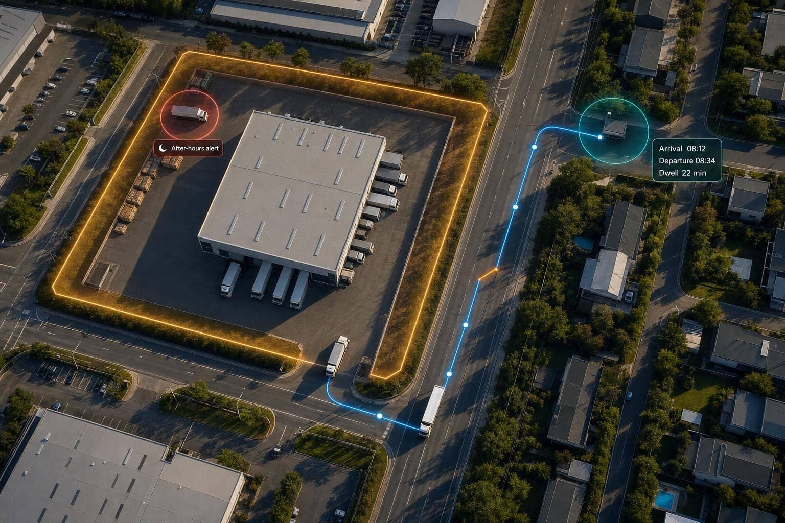
5 Jul 2026
Geofencing for Fleet Management: How It Works
Turn vehicle GPS pings into arrival/departure logs, dwell-time, route-deviation checks and after-hours alerts for fleets.
5 Jul 2026
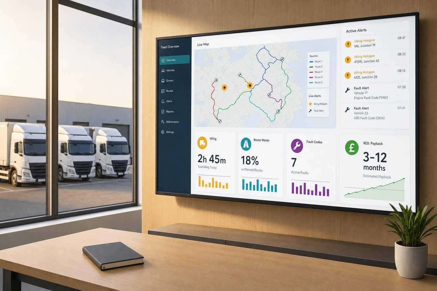
Telematics Data Visualisation: ROI for Fleet Operators
Telematics dashboards reveal idling, route waste and fault codes to cut fuel, maintenance and incidents and show ROI at 3–12 months.
5 Jul 2026
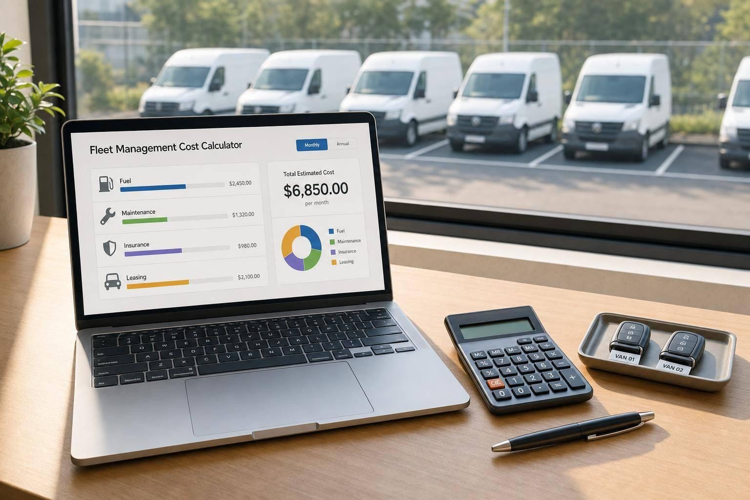
Fleet Management Cost Calculator
Estimate monthly or annual fleet running costs, compare cost categories, and plan budgets with a practical fleet management cost calculator.