How Smart Parking Solves Last-Mile Delays
Live bay data, bookings and van tracking cut parking search time, fines and last‑mile delays for urban fleets.
 By Michael Bar9 min read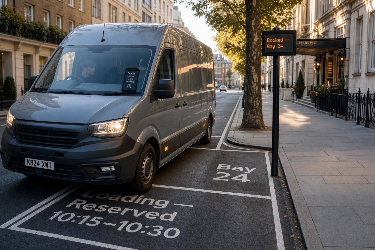
Parking can add 5.8 minutes per stop in busy UK streets, and that lost time can push daily delay to 28–50 minutes. My view is simple: smart parking helps fix last-mile delay by showing drivers legal bays before they arrive, linking bay data to route plans, and tracking dwell time so one late stop does not wreck the rest of the round.
If I strip the article down to the parts that matter most, it says this:
- Search time is the hidden problem. Drivers lose time circling because of red routes, loading bans, yellow lines and short-stay bays.
- Live bay data cuts wasted minutes. In one study, parking search time fell by 28% and total tour driving time fell by 16%.
- Booked bays add more control. Reserving a slot can help fleets hit time windows and avoid turning up to a full bay.
- Routing works better with kerbside data. Instead of sending a van to an address and hoping for the best, planners can send it to a legal bay near the drop.
- Van tracking helps protect booked slots. Live location, ETA and geofencing show when a driver may miss a slot or stay too long.
- Dwell time matters. Many urban bays allow only 20 or 40 minutes, and most van drops take about 10 minutes.
- Overstays cost fleets twice. They can lead to PCNs and also throw later stops off schedule.
- The result is fewer delays and fewer fines. Trials in London linked dynamic kerb management with a 21% delivery efficiency saving, plus lower NOx and CO₂ in test areas.
Here’s the short version: if you know where to stop, when to arrive and how long the van stays there, you can cut a big chunk of last-mile delay.
Cleverciti: Smart Parking with AI and IoT means less congestion and CO2
Quick Comparison
| Area | Without smart parking | With smart parking |
|---|---|---|
| Finding a bay | Drivers circle and guess | Drivers see free or reserved bays |
| Route planning | Built around address only | Built around address and bay access |
| Slot timing | More missed windows | Better ETA control |
| Dwell time | Hard to track | Measured with geofences and alerts |
| PCN risk | Higher | Lower with legal stopping guidance |
| Daily output | More time lost at the kerb | More drops fitted into a shift |
So when I look at last-mile delivery trends in UK cities, I do not see parking as a side issue. I see it as one of the main causes of late delivery.
How live bay data cuts time spent searching for a space
Live bay data takes a lot of the guesswork out of the job before the van even turns into the street. When drivers can see which bays are free, route planning can point them to stops that are both legal and open.
What live kerbside data shows drivers
A smart parking system should show bay status, loading rules, operating hours, vehicle eligibility and dwell time at a glance. If a driver can see that a bay allows a 20-minute stop, they can plan the drop with that limit in mind. That means less time spent hunting for a space before they reach the kerb.
When kerb availability information is visible before arrival, drivers spend less time circling and more time making the drop. In a controlled study, cruising time for parking fell by 28% and total tour driving time dropped by 16%.
How smart bays and reservations improve access
Smart bays use sensors or cameras to send live occupancy data to a central platform. Digital loading zones can add on-demand kerbside space when standard bays are full. Drivers can then be guided to those zones through their navigation app, which gets them nearer to the drop.
The most structured option is a pre-booked bay system. Here, a fleet planner or driver reserves a specific bay for a set time window - say, 09:10–09:30 - through a platform linked to the local authority's kerbside management system. Southwark Council's bookable bay scheme shows how reservations can work on busy streets, giving fleets more predictable access and cutting wasted arrival time.
Many fleets use a hybrid setup:
- Pre-booked slots on streets with heavy demand
- Live-status smart bays across the rest of the route
That same live kerbside data can also feed route planning and van tracking.
Connecting parking data to routing and van tracking
Once bay availability is known, the next step is to plug it into routing and tracking. Live bay data matters most when it shapes route planning and van tracking in real time.
Planning routes around bay availability
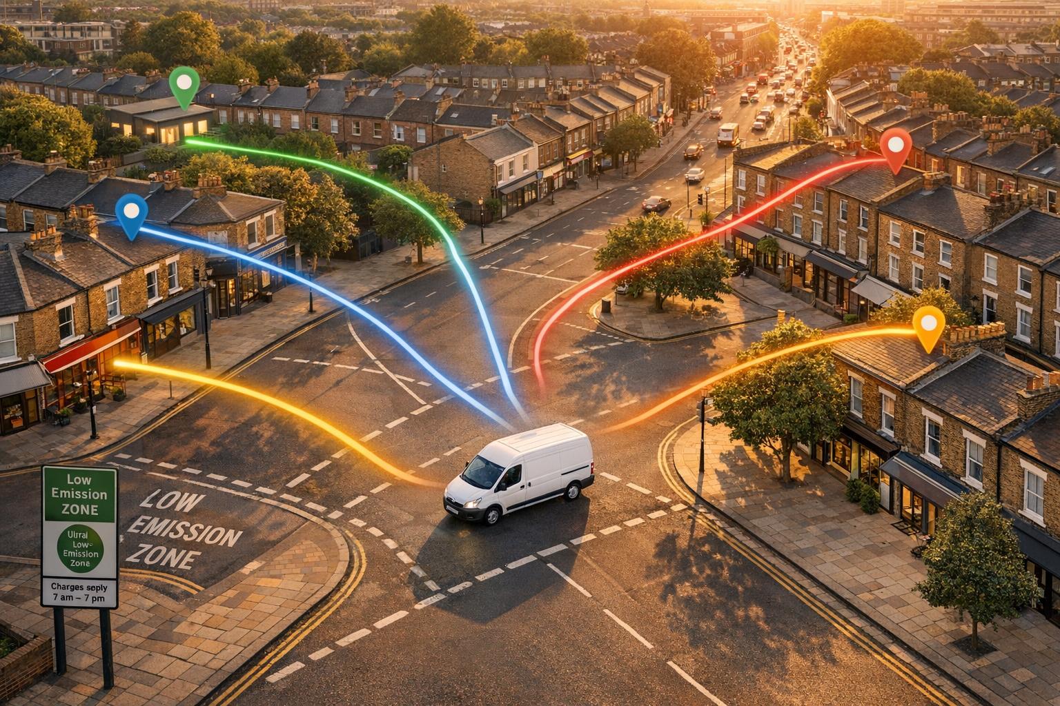
Standard routing sends a driver to a customer address and leaves parking to luck. A smarter setup plans stops around both drive time and likely bay availability, so each delivery is matched to a nearby loading option before the route is locked in.
Here’s how that looks in practice. A dispatcher imports the day’s orders into the planning system, which then checks live kerbside data for each stop and reviews the restrictions in force. The route is then reordered around customer time windows and bay availability. A drop near a busy loading bay in central London, for example, might be placed in a predicted low-occupancy period, while stops with more flexible kerbside options are shifted to busier parts of the day.
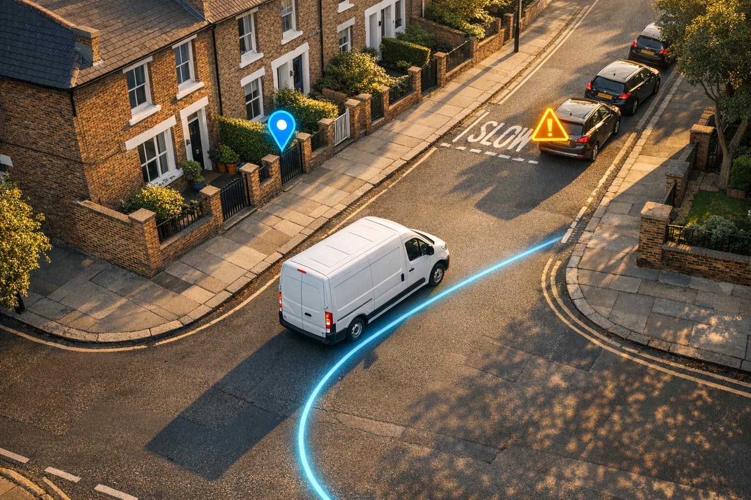
Drivers aren’t just sent to an address. They’re sent to a specific bay, with clear guidance on walking distance and maximum stay. That cuts the chance of turning up only to find a booked bay has already gone.
Live bay data helps planners trim parking-search time and keep dwell time within limits. Digital booking systems for loading bays have also been linked to a reduction in Penalty Charge Notices of as much as 40%. At that point, dispatch also needs live vehicle location data to check whether each van is still on course for its booked slot.
How van tracking supports better kerbside decisions
Van tracking turns a route plan into live action. When a telematics system knows a vehicle’s live location, speed and ETA, it can spot when a driver is running late for a booked bay window and give dispatch time to step in before the slot is lost.
Geofencing adds another layer. By drawing virtual boundaries around loading bays, red routes and restricted zones, fleets can record automatic entry and exit timestamps each time a van crosses those boundaries. That makes dwell time measurable and triggers alerts when a vehicle is at risk of overstaying.
Over time, this data shows which streets keep causing delays. That knowledge then feeds back into better route efficiency on future runs.
GRS Fleet Telematics supports this with real-time van tracking, geofencing and time-stamped arrival and departure logs from £7.99 per vehicle per month.
Dwell-time control and its effect on missed slots
Why dwell time matters at busy delivery stops
Live bay data helps, but it doesn't solve everything. A stop can still go wrong if the vehicle stays too long.
Dwell time is the total time a vehicle occupies a parking or loading bay from arrival to departure. That includes unloading, paperwork, and any waiting time before the driver moves off. Most van deliveries take around 10 minutes.
On paper, that may not sound like much. In busy town and city centres, though, even a short overstay can jam the system. One vehicle runs past its slot, the next driver loses the bay, and the whole route starts to drift. At a high-pressure central stop, a single delay can spill into several later drops.
London loading bay rules often set a maximum stay of 20 minutes. Across the capital, 20 or 40 minutes is common, depending on the bay type and the borough. Go over that limit and the driver may face a Penalty Charge Notice. But the bigger issue for fleets is simpler: every overstay cuts the number of vehicles that bay can handle in an hour. If you're running a tight multi-drop route, that hurts fast.
Using tracking data to manage overstays and missed slots
This is where dwell-time data gives dispatch something they can act on. The practical step is simple: measure fleet productivity and dwell time at every stop.
Telematics data can track dwell time at each geofenced stop and break it down by location, time of day, and customer type. That makes problem spots easier to see. Some sites will keep showing up as overstay risks, and that gives fleet managers a clear place to start.
From there, teams can make direct changes, such as:
- adjusting booked time slots for harder drops
- working with customers to speed up on-site steps
- spotting kerbside hotspots that need a different route or booking choice
Urban delivery pilots have shown that structured 30–45-minute delivery windows can cut average dwell time at loading zones by roughly 15–30%.
When a van stays inside a geofenced bay longer than its allowed window, GRS Fleet Telematics can send an alert to both the driver and the control room. That gives dispatch a chance to step in before one late stop turns into two or three.
What smart parking delivers for UK fleets
Smart Parking vs Standard Parking: Last-Mile Delivery Impact
Standard parking practice vs smart parking-enabled delivery
Once live bay data, routing and dwell-time control are in place, the effect shows up fast in day-to-day fleet work.
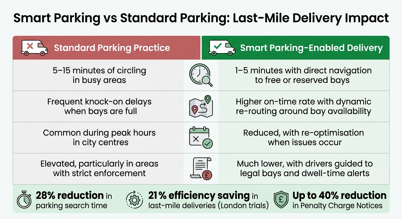
In dense urban areas, real-time kerb occupancy data can cut route times by up to 20.4%. Grid Smarter Cities' dynamic kerbside management trials in London recorded a 21% efficiency saving in last-mile deliveries, along with a 6.6% reduction in NOx and a 4.6% reduction in CO₂ emissions in trial areas. In plain terms, that can mean more drops per shift, lower fuel use and fewer fines.
You can see the gap most clearly when standard parking practice is set against smart parking-enabled delivery.
| Metric | Standard parking practice | Smart parking-enabled delivery |
|---|---|---|
| Parking search time per stop | 5–15 minutes of circling in busy areas | 1–5 minutes with direct navigation to free or reserved bays |
| Route reliability | Frequent knock-on delays when bays are full | Higher on-time rate with dynamic re-routing around bay availability |
| Missed delivery slots | Common during peak hours in city centres | Reduced, with re-optimisation when issues occur |
| Fines per vehicle per month | Elevated, particularly in areas with strict enforcement | Much lower, with drivers guided to legal bays and dwell-time alerts |
Predictable bays also cut unsafe stops, such as double-parking or blocking cycle lanes.
That gain comes from three linked actions: better bay visibility, AI route optimisation and tighter dwell-time control.
Conclusion: How smart parking solves last-mile delays
Smart parking closes the gap at the kerb. Live bay data cuts search time, routing improves arrival accuracy, and dwell-time monitoring - backed by van tracking tools such as GRS Fleet Telematics - helps prevent overstays and missed slots. Together, they turn parking into a controlled part of the last mile.
FAQs
How does smart parking reduce delivery delays?
Smart parking tools cut delays because drivers spend less time circling packed city centres looking for a space. With sensors and live kerb data, they can find or book loading bays before they arrive. That cuts cruising time by more than 27%.
Pair that data with routing systems, and things get smoother. Live bay availability lets fleets plan stops based on where parking is actually open, which helps avoid slow, frustrating re-routing. Digital bay booking also helps secure parking on arrival and reduces the risk of Penalty Charge Notices.
What data does a smart parking system need?
A smart parking system needs both live and predictive data.
It uses in-ground or IoT sensors to track whether bays are occupied and show current availability. It can also factor in vehicle details, such as size, so vans are directed to spaces that fit them.
On top of that, it uses past occupancy data to estimate whether a space is likely to be free when the driver is due to arrive. The system can also connect with digital payments, geofencing and telematics to track dwell times and spot parking-related delays.
How can fleets control dwell time at busy stops?
Fleet operators can use telematics to see exactly how long a vehicle sits at each stop. Add geofencing, and arrivals and departures are logged automatically. That makes it much easier to spot repeat bottlenecks, slow turnarounds, or loading times that keep dragging on.
When you pair that data with AI-driven route planning, ETAs become more accurate and schedules can be adjusted before delays start to pile up. GRS Fleet Telematics offers real-time tracking tools that help teams monitor these patterns and cut down on avoidable hold-ups.